Overview: Sweetbay Natural Area has nearly 1,100 acres of pinelands and wet prairie carved out of the North County General Aviation Airport site in northwestern Palm Beach County. Despite the impressive spread, the opportunities for hiking are rather limited. There is one, short, accessible trail that splits, one fork ending at covered overlook and the other looping around. Total distance: 0.35 miles. At first, it might seem underwhelming, but Sweetbay tends to grow on you as you spend time there.
Sweetbay's limited scope gives you a chance to slow down, to explore the trees with your eyes for birds, to sift through the understory for the plethora of wildflowers that grow here, some of which are rare. Sit under the covered observation platform and taken in the silence and the surrounding vast wet prairie. With time and patience, who knows what you might see? Almost anything is possible. The one slight downside to Sweetbay is the occasional drone of planes landing at the airport.
Note: Do not go beyond Sweetbay's trail system. Airport security concerns could get you in trouble if you wander the site.
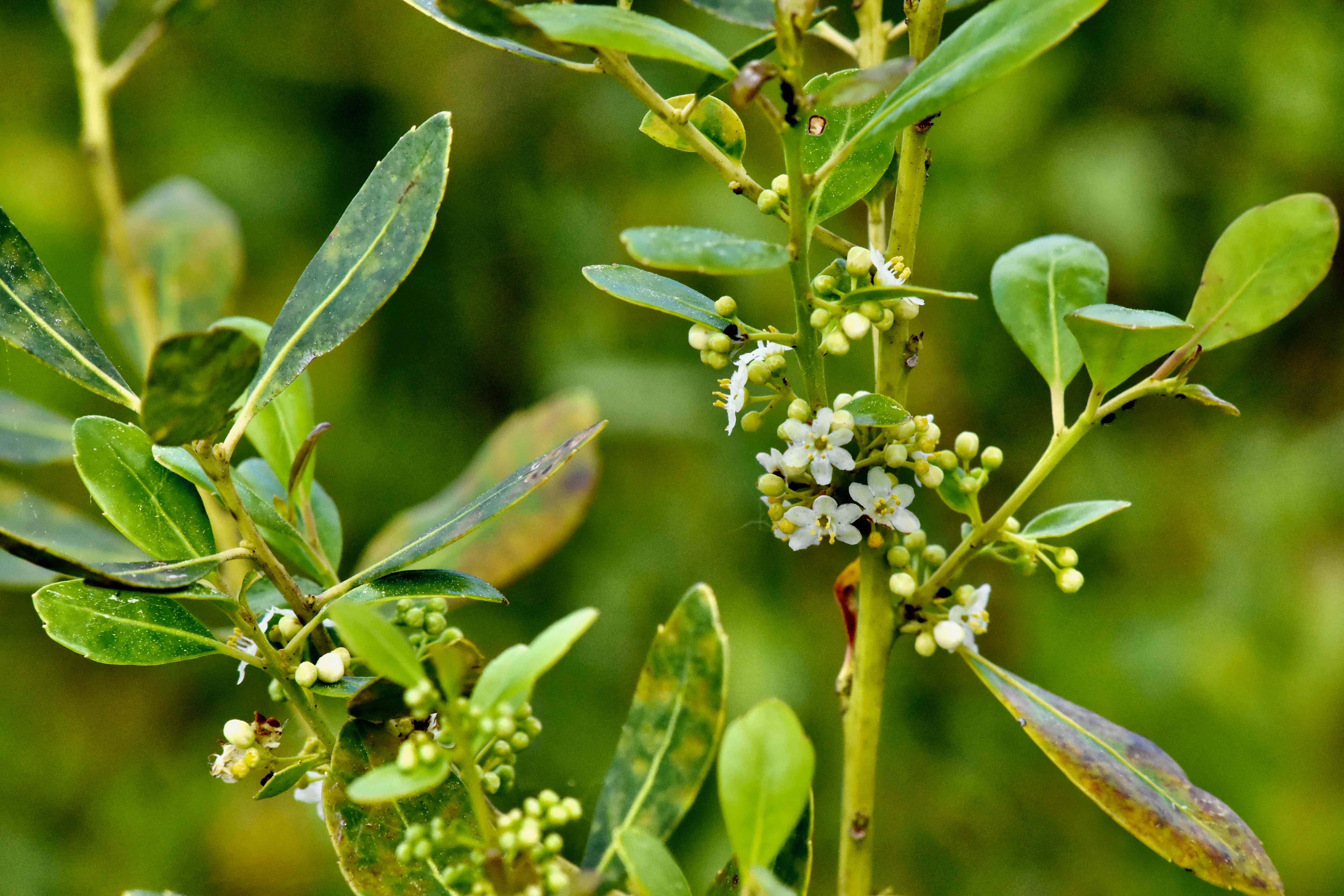
A bayhead seen from the observation platform. These mixes of sweetbay, dahoon holly and willow trees provide critical habitat for birds and other animals.
History: Sweetbay Natural Area was conceived in the early 1990s as part of the North County General Aviation Airport project. Slightly more than half of the site's 1,832 acres — 925 acres — were to be set aside for the preserve with the possibility of expanding the site and protecting sensitive lands within the airport part of the project.
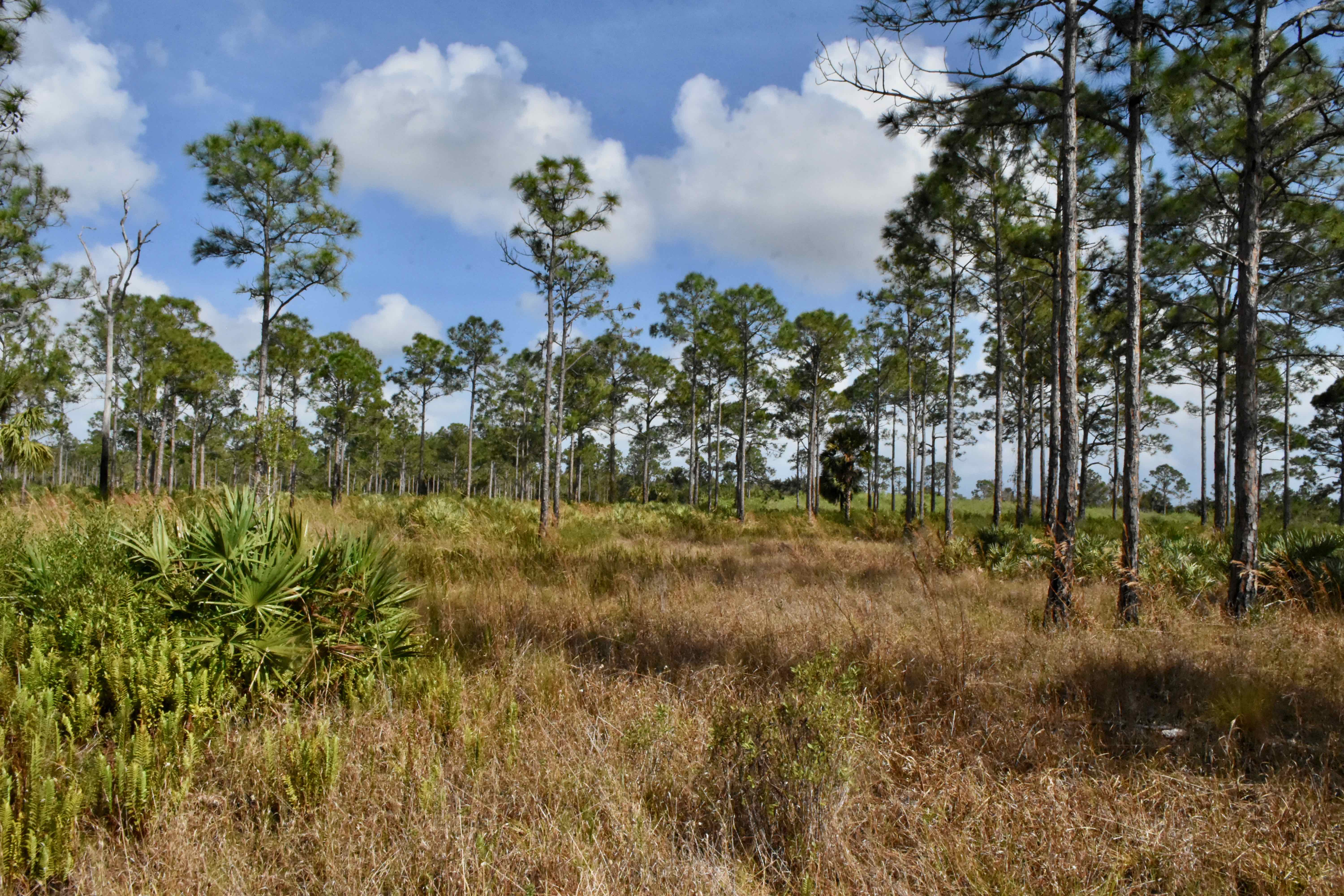
In the decades before construction of the airport and the creation of Sweetbay Natural Area, the land was extensively logged. The pines you see are remnants of that era, trees that at the time were too small to use as lumber. Other parts of the site were farmed; drainage ditches and mounded rows where crops once grew still speak to that era. Also of note: Sweetbay sits amid the areas once drained by both the Loxahatchee Slough into the Loxahatchee River, and the Hungryland Slough, which fed the northern Everglades.
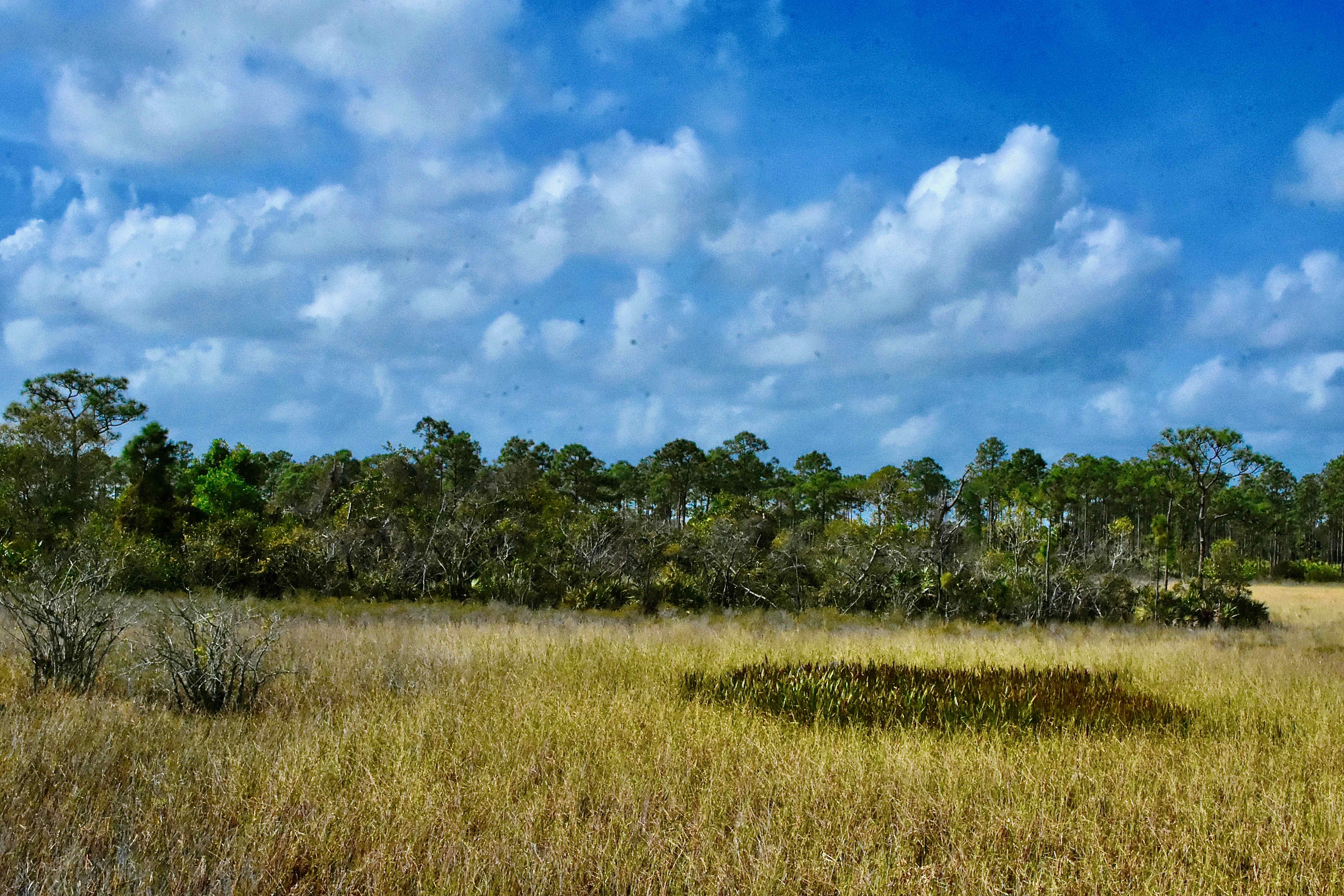
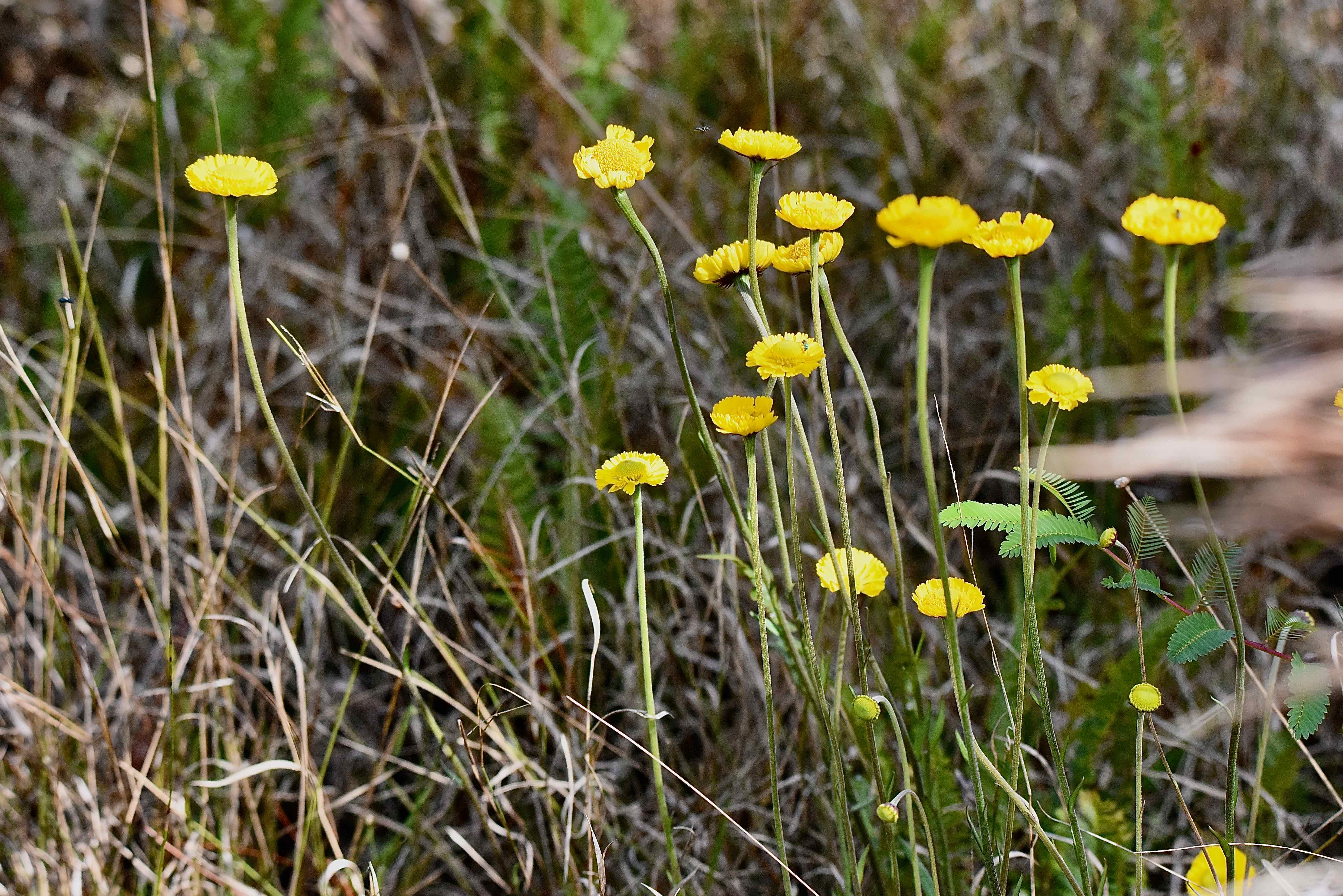
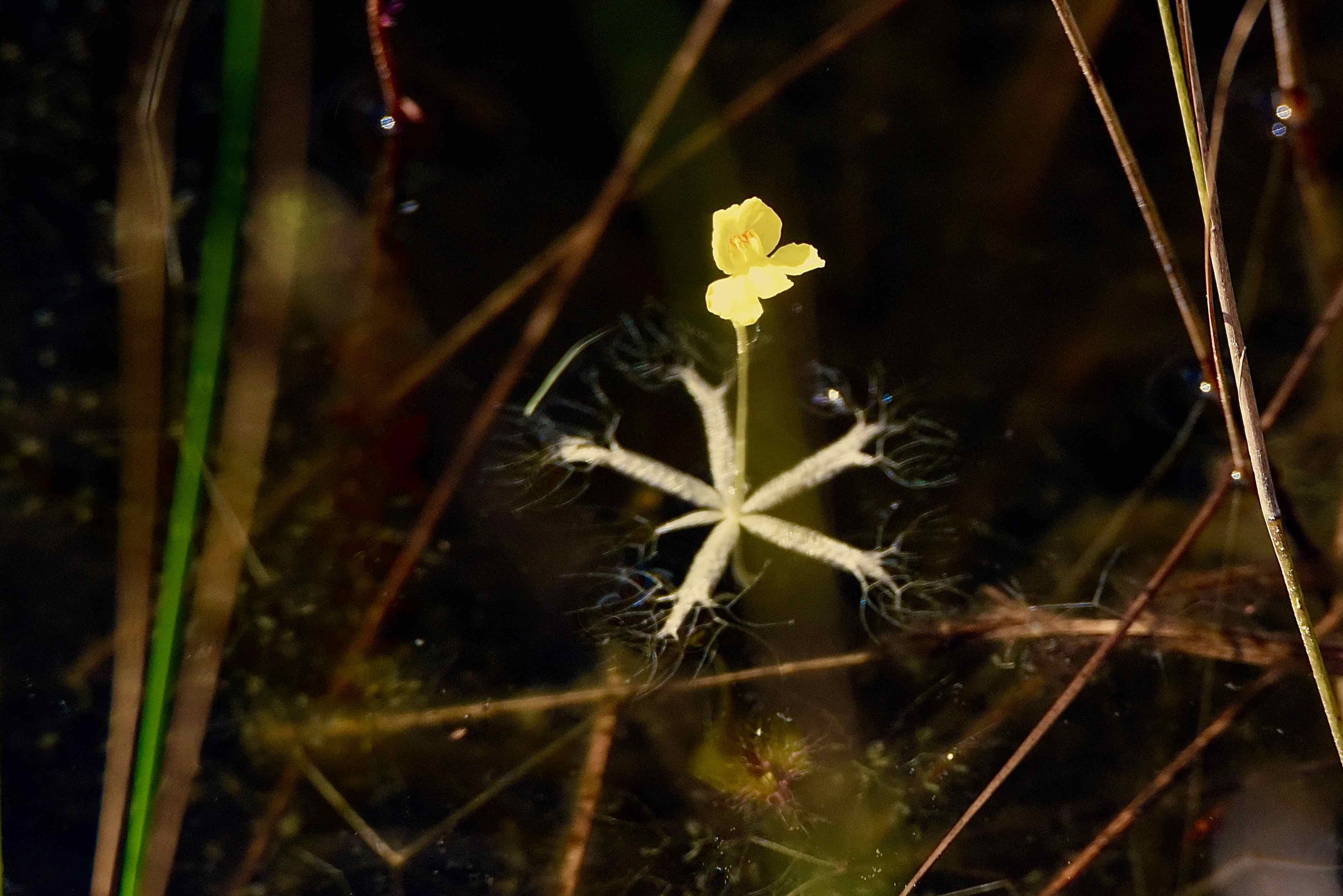
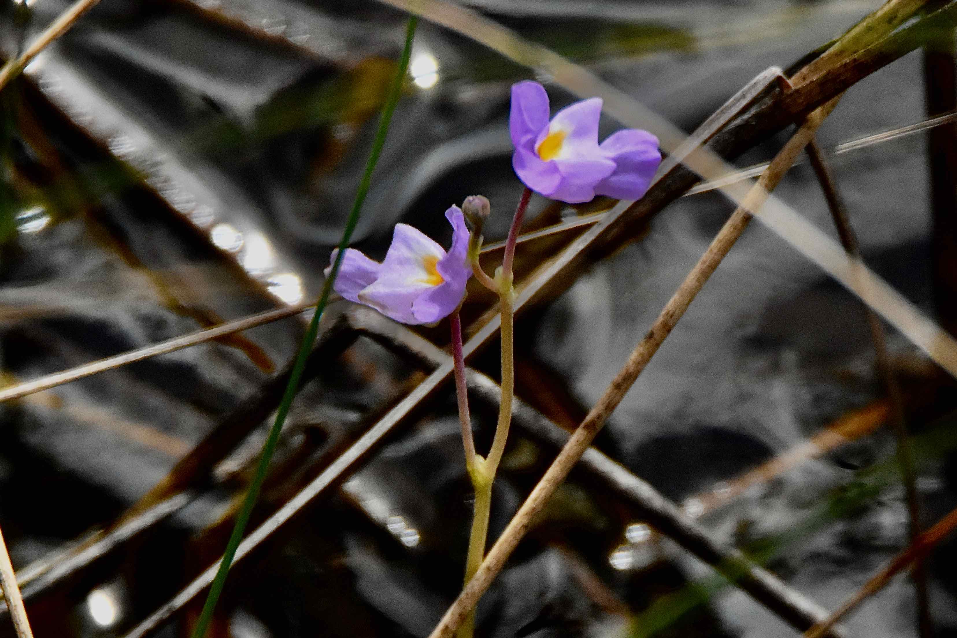
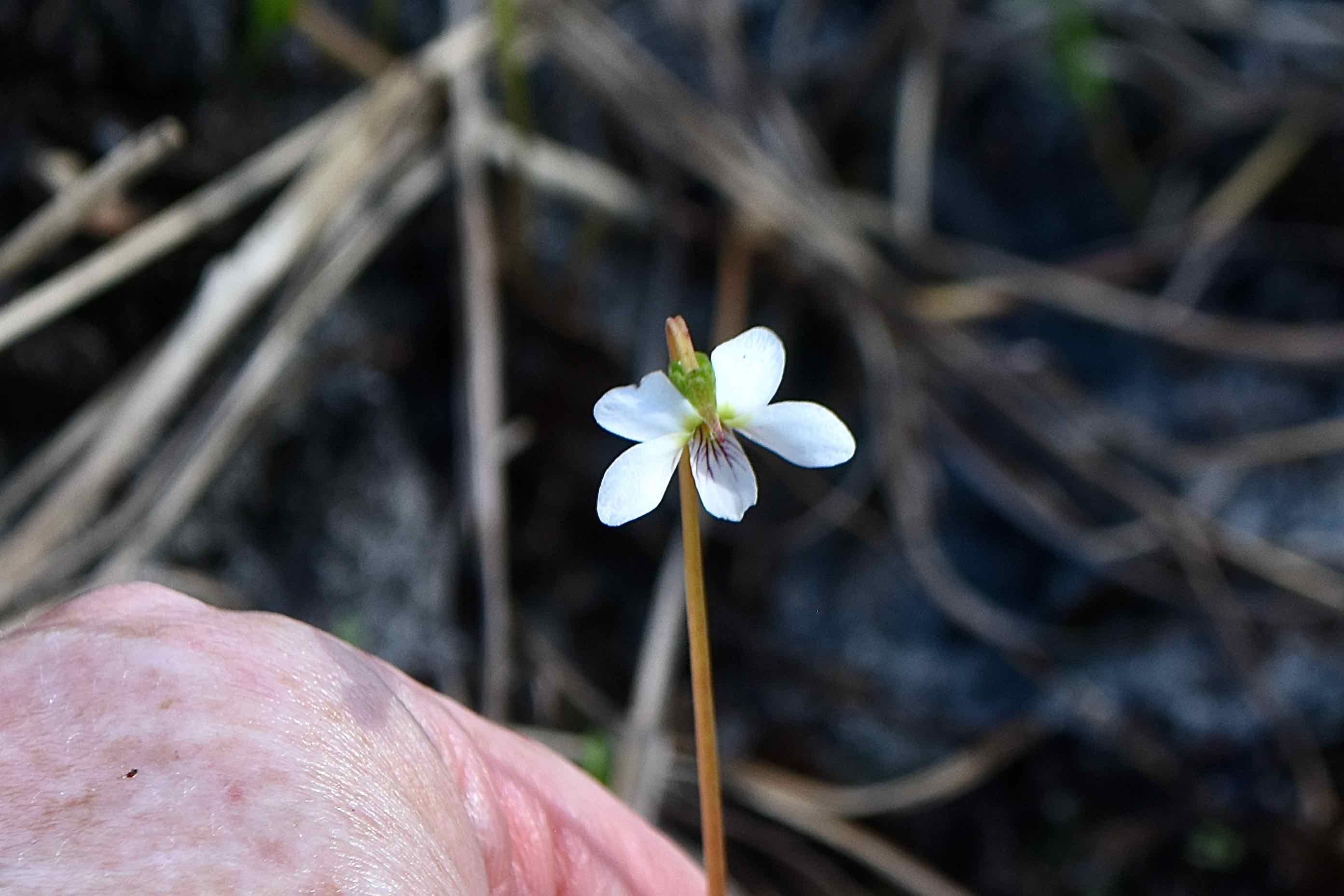
What You'll See: Sweetbay is predominantly wet prairie and pine flatwoods, dotted with a few cypress domes and bayheads — small islands in the sea of grasses and sedges that's the inspiration for the name. It's a beautiful, quiet place. As you move along the trail, look for bog white violets, southeastern sneezeweed, pitted stripeseed and other wildflowers. From the observation platform, look into the nearby waters and spot bright yellow flowers suspended in the water. This is little floating bladderwort. There are also small, violet-colored flowers called eastern purple bladderwort. Both of these flowers are carnivorous and rare.
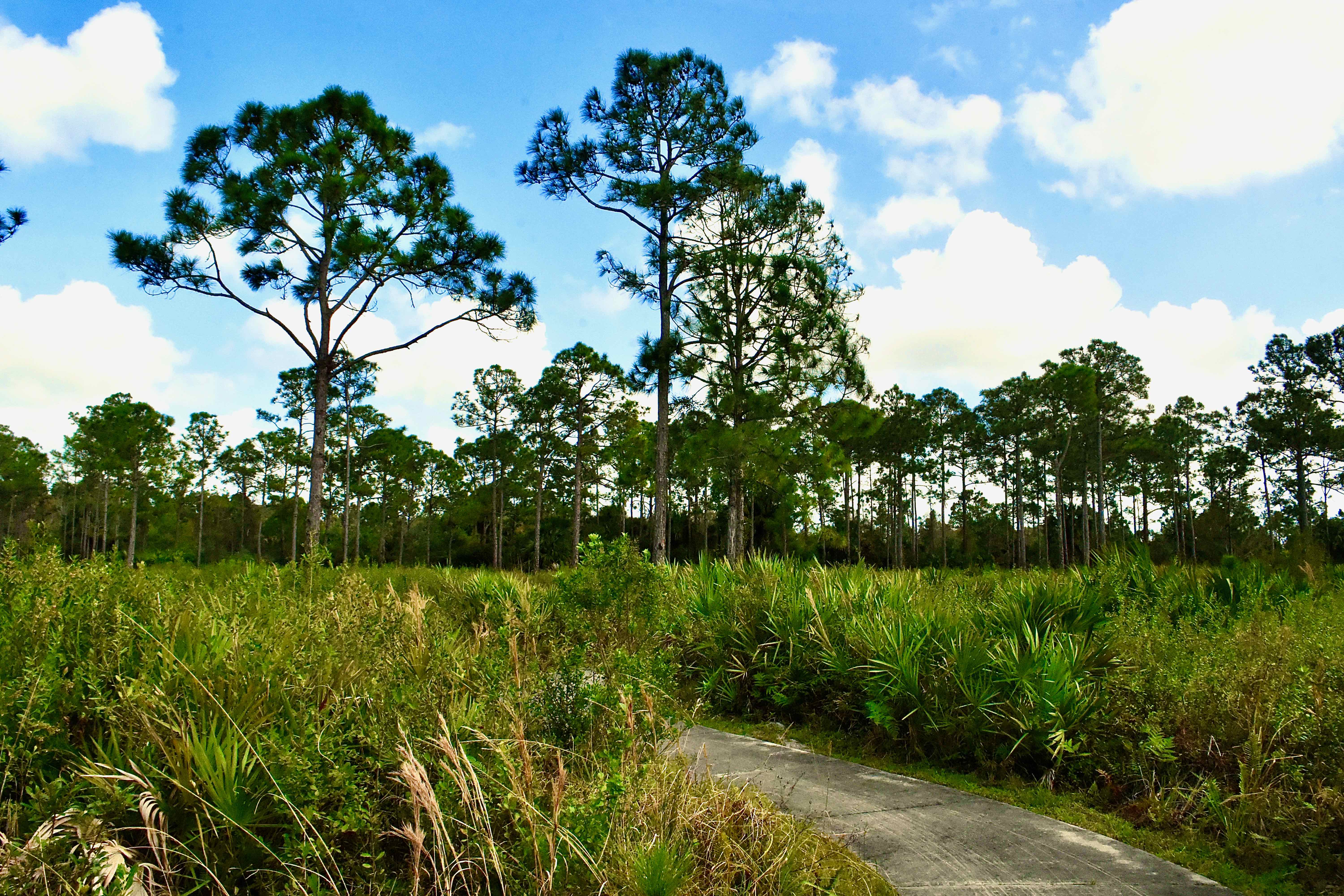
Amenities: There is a small parking lot that's more than adequate for the traffic Sweetbay typically receives, an informational/interpretive kiosk, a covered observation platform with seats and 0.35 miles of hard surface (concrete) trails. There is no restroom or drinking water on site.
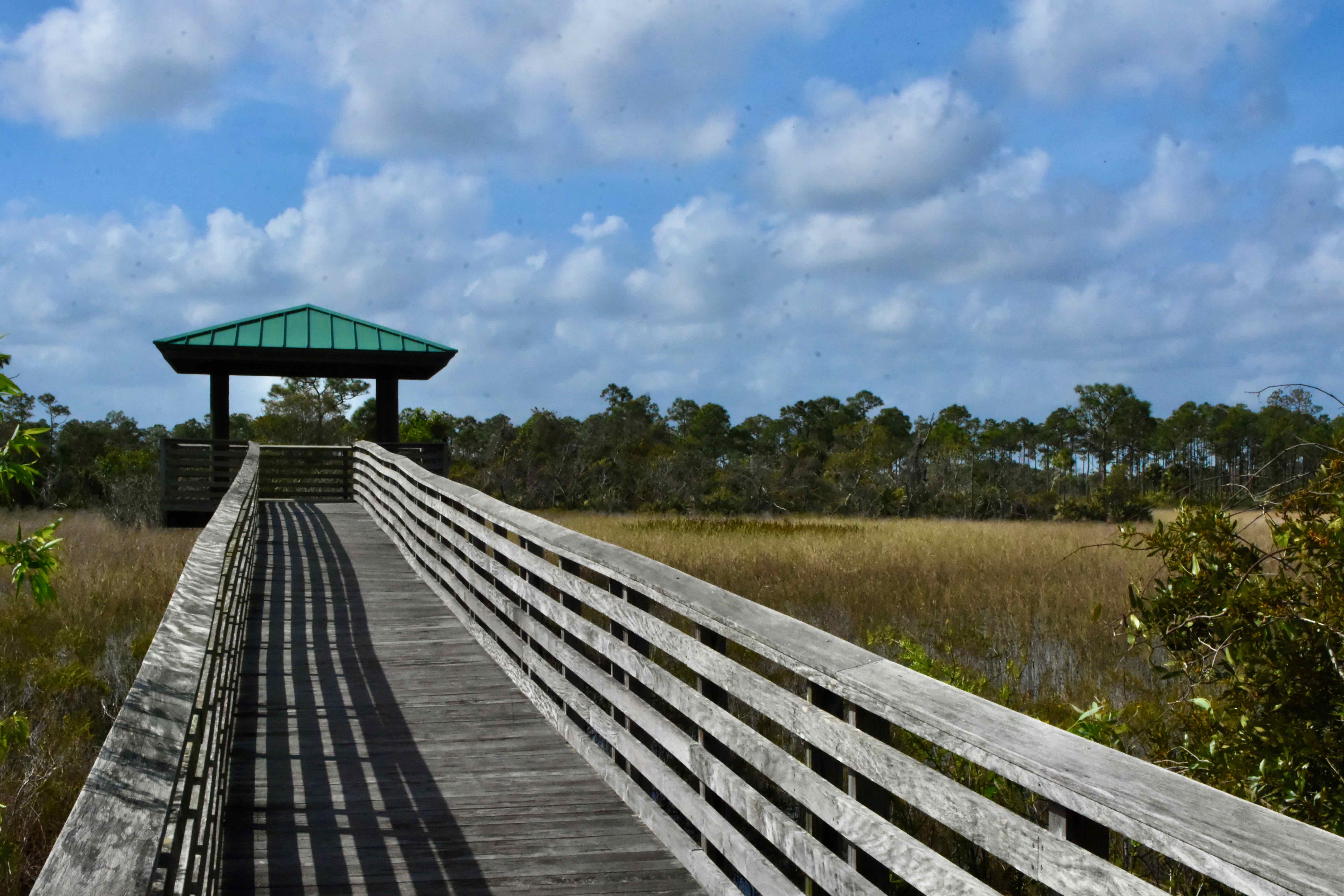
The trail at Sweetbay is concrete and a little more than a third of a mile long. A portion loops through some flatwoods, while a section leads to an observation platform in the wet prairie.
Links: The Great Florida Birding Trail's take on Sweetbay Natural Area is here.
Of Note: The entrance to Sweetbay Natural Area sits along Aviation Boulevard just west of the Bee Line Highway. It is open sunrise to sunset everyday of the year. Admission is free.
Cover Photo: A sandhill crane troops through the wet prairie to the observation platform.
Virtual Tour
The largest single habitat type at Sweetbay Natural Area is wet prairie, made up of grasses, sedges, shrubs and other plants that can tolerate places that are under water a good portion of the year. Where the land is a little higher, bayheads form, filled with sweetbay trees, dahoon holly and willows.
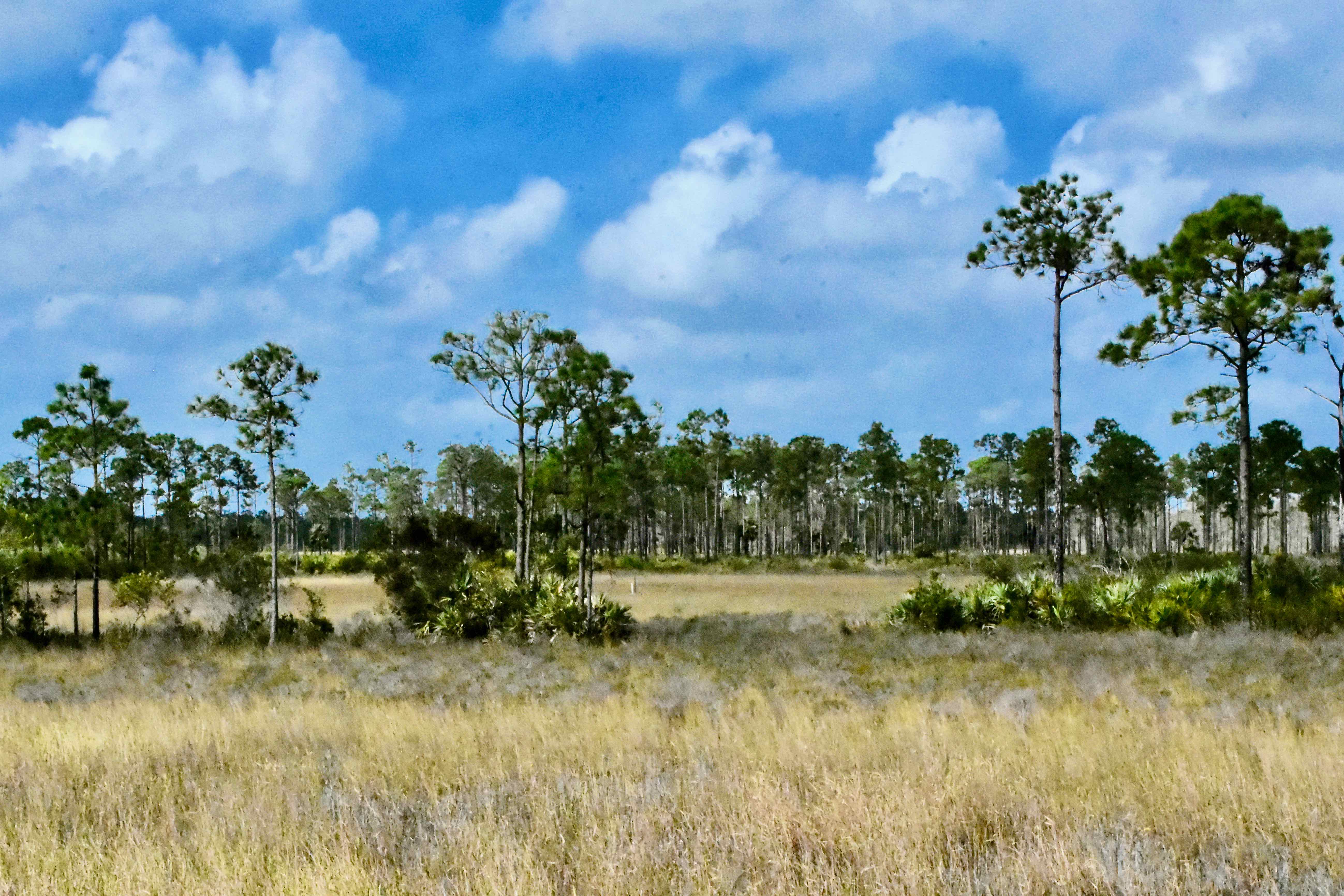
Where the land is higher still, flatwoods form with slash pines dominating the canope. Even here, the land can be wet a good portion of the year. In a completely natural state, the land here both floods and burns frequently.
One fork of the trail through Sweetbay Natural Area leads to this observation platform. It's an ideal place to take in the sweeping panorama of the preserve. If you look down from the platform, you'll see small yellow and purple flowers. These are the bladderworts, carnivorous plants that trap and kill microscopic plants and animals.
Getting There ...
DIRECTIONS: The only way to access Sweetbay Natural Area is via the Bee Line Highway. It can be reached from the Turnpike by exiting at North Jog Road and turning right onto the Bee Line. From I95, exit at either PGA Boulevard or Blue Heron Boulevard and head west to the highway. From PGA, Sweetbay is three miles away; from Blue Heron, it's nine miles; from Jog Road, it's 7.8 miles.
Photo Gallery for Sweetbay Natural Area
Click on the photograph to see an enlarged image. Click on the name to read more about the species.